One of the most dangerous roads on Earth
Pictures from Pangi Valley
“Five of us packed into a car, allured by the promise of traversing one of India’s most breathtaking and most dangerous roads” – in winter.
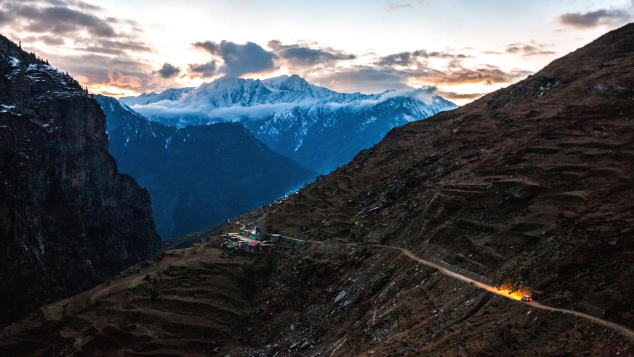
Five of us packed into a car, allured by the promise of traversing one of India’s most breathtaking – and most dangerous – roads. The Pangi via Kishtwar road passes through two remote districts, Jammu and Kashmir, and connects the mythical valley of Pangi – hidden between the Pir Panjal range and the Zanskar range of the Western Himalayas – to the outside world when the regular route (via Saach Pass) is blocked due to snowfall.
Pictures from Pangi Valley
Pictures from Kishtwar, Kashmir
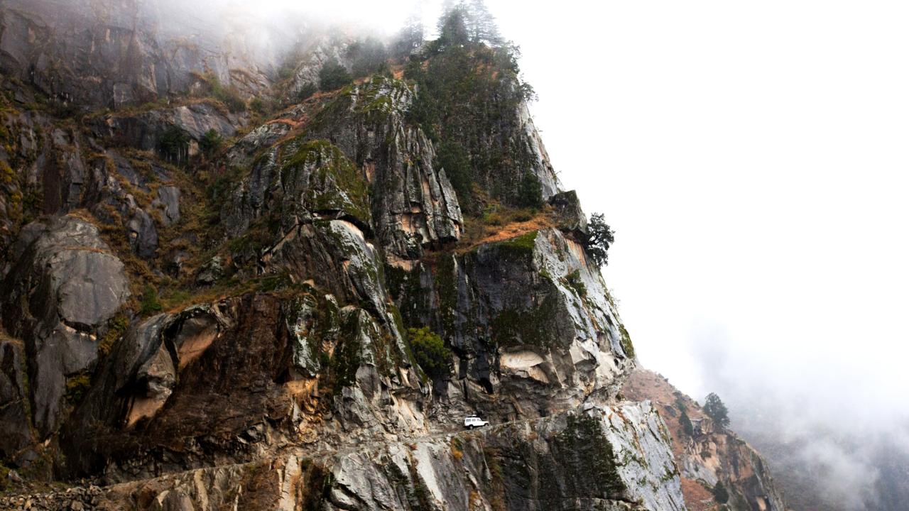
In November, the weather is normally volatile. Snowfall can leave the Pangi valley in complete isolation for months. Yet, we were determined to make the trek. From one of India’s premier six-lane highways in the sprawling, northern commercial city of Chandigarh, the roads narrowed and we eventually began our two-day ascent along the former mule track. Now barely a one-lane dirt road, the route had been dynamited into the mountainside only a few years earlier.
Pictures from Pangi Valley
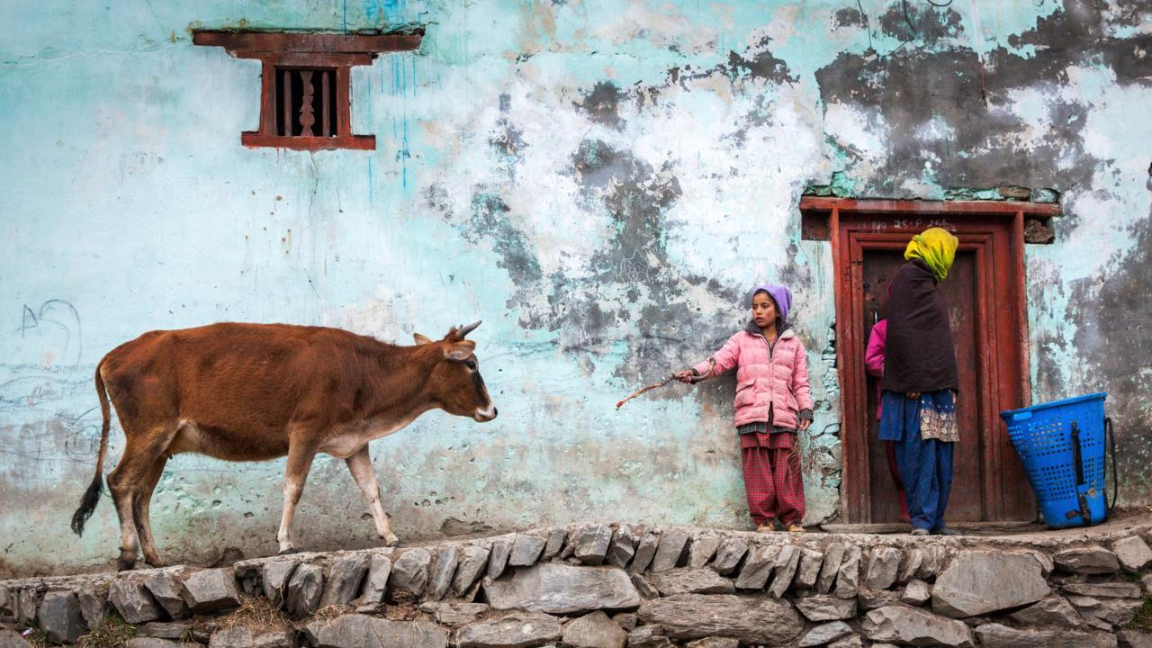
Local lore has it that the people of Chamba, fleeing Mughal invaders, settled the hidden Pangi valley. Noble families would send their women and children to Pangi to live in peace and secrecy. When the valley later came under the rule of the Kingdom of Chamba in the 16th Century, officials posted here were given funeral allowance, since they were expected to never return home. According to another legend, the King of Chamba sent criminals to the valley to serve life sentences.
Pictures from Pangi Valley
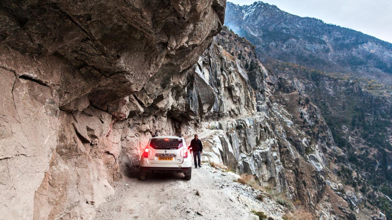
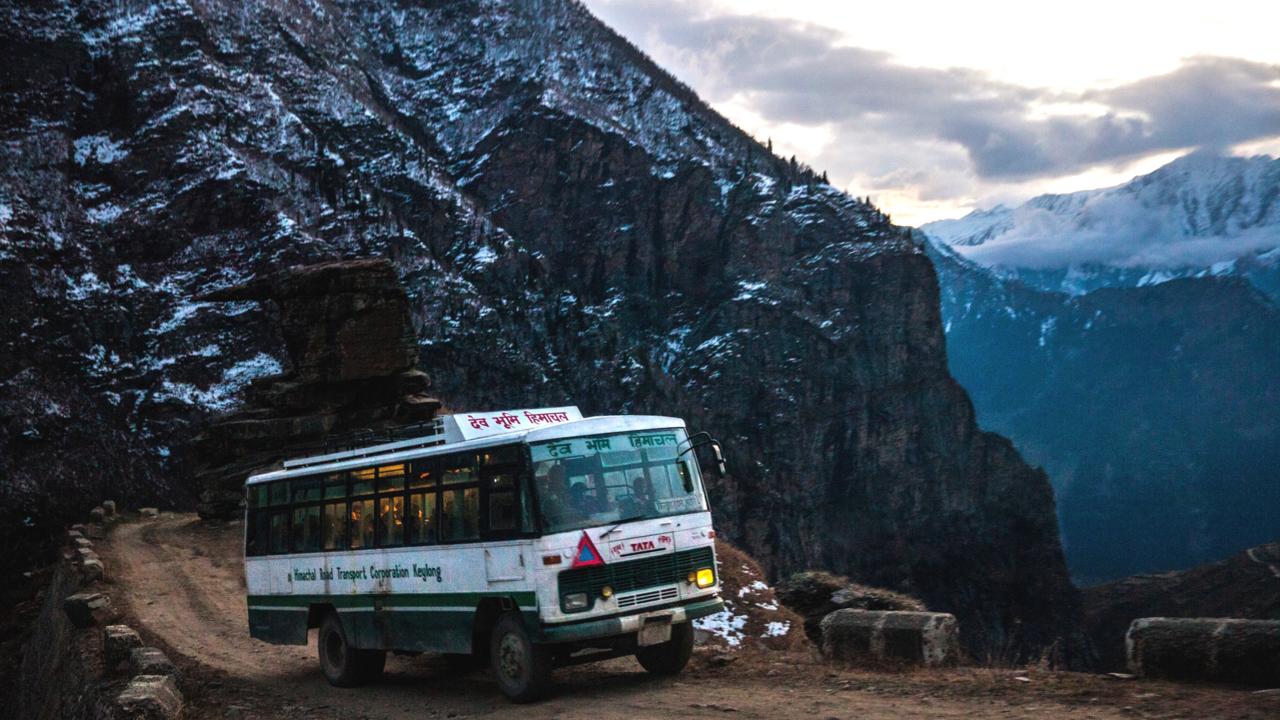
The Pangi via Kishtwar road cuts rights through mountain ledges, and for the most part, is only wide enough for one car at a time. Somehow though, brave bus and truck drivers ply the route too. If two cars meet each other going opposite directions, one driver has to carefully drive in reverse for potentially hundreds of metres until a suitable passing spot is reached. All along the road, cliffs shoot straight up to the tops of mountains, and then straight down thousands of metres to the rubble-strewn banks of the Chenab River. The road is so rocky and steep that one 30km stretch took us four hours to cross.
Pictures from Pangi Valley
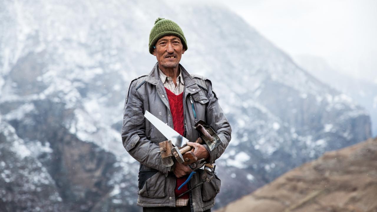
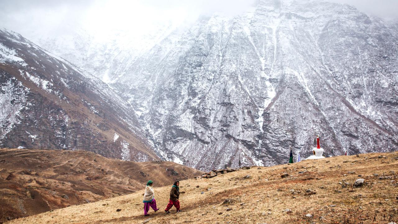
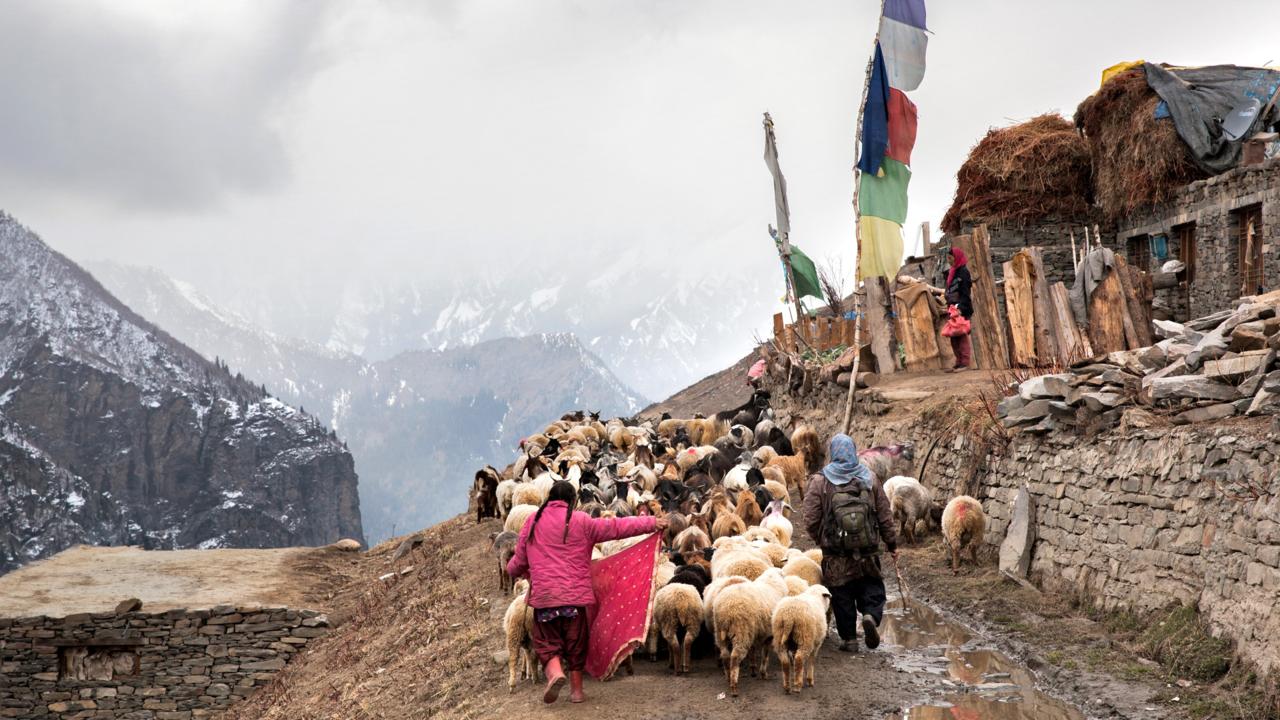
Along the way, we encountered locals who are used to the treacherous roads and landscapes that surround them. The Pangwal, descendants of the original settlers, have small agricultural farms along the route. And at higher altitudes, the Bhot people – who speak Tibetan languages and mostly make a livelihood herding animals – weather the harsh conditions by preserving meat, storing barley and brewing a type of hard liquor known locally as patru or rakh. Winter, when the whole valley is engulfed in snow, is the most difficult time for the locals. Reaching Chamba takes two days by road, and during medical emergencies, the government arranges helicopter service for the people.
Pictures from Pangi Valley
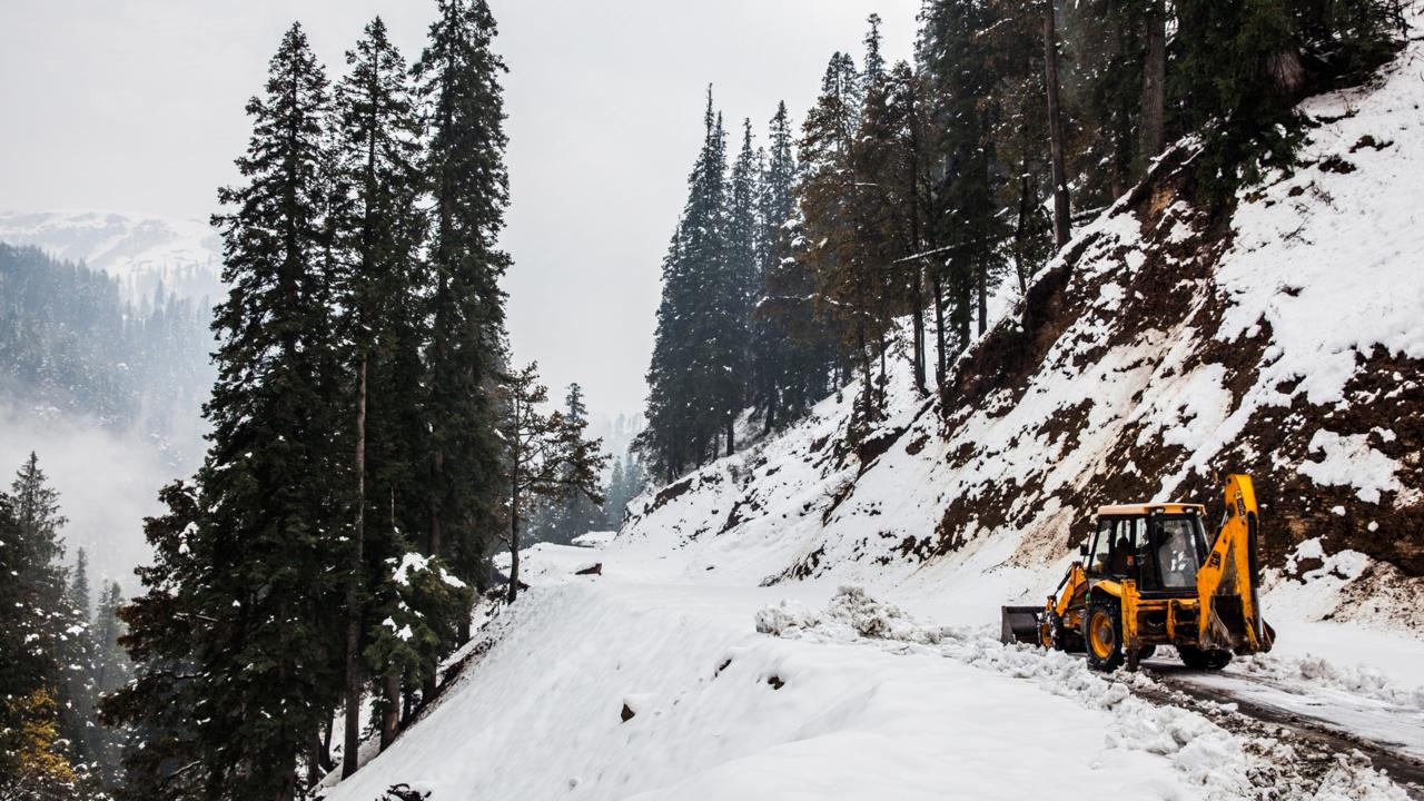
On our descent back home, we experienced some of these harsh conditions first hand. Clouds rushed up the valley blanketing us in a thick fog, and a light drizzle turned the road into a slushy mess. And as we dropped in elevation, it was snowing, making the road even more slippery and dangerous. The 52km stretch to Gulabgarh – our safe zone near the river – took us eight hours to cover. Had we not left when we did, we might have spent much more time in that mountain paradise than we’d bargained for.
Pictures from Pangi Valley
Pictures from Pangi Valley


Политика конфиденциальности | Правила пользования сайтом