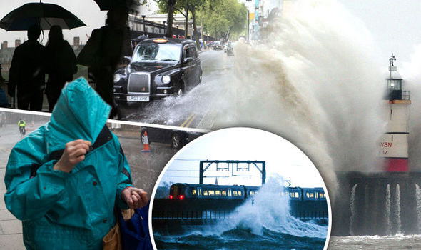
Bank Holiday Monday WASHOUT: Weather warning as Storm Katie batters UK with 70mph winds

BRITAIN faces Bank Holiday mayhem as megastorm Katie unleashes hurricane-force gales and torrential downpours today.
The Met Office said almost a month’s worth of rain could fall with intense downpours dumping an inch in parts in a matter of hours.
Tens of thousands of people travelling home after the Easter break can expect chaos on the roads, railways and transport networks.
Swathes of the country are braced for power cuts, fallen trees and floods with warnings to adjust plans for severe weather.
Gusts of more than 70mph have been recorded throughout southern England with fierce gales threatening to whip up mammoth 20ft waves.
We expect 50 to 60mph gusts in land and 70mph around exposed coastal regions

Met Office forecaster Marco Petagna
The Met Office issued severe weather warnings for strong winds across the region ahead of gales powerful enough to topple trees and damage buildings.
Another alert is in place for heavy rain with intense downpours on fallen debris sparking warnings to expect floods.
Katie swept in off the Atlantic late yesterday evening with most of England and Wales battening down the hatches for disruption throughout today.
Met Office forecaster Marco Petagna said although the worst of the storm will pass by the end of the day and the week will start wet and windy.
The Met Office warned people travelling home after the Easter break to take extra care with fallen debris and power outages possible.
Fierce winds will drive torrential downpours with more than an inch of rain expected to hit some areas in a matter of hours.
Met Office chief forecaster Will Lang said: “An area of low pressure will rapidly deepen to the southwest of the UK later on Sunday and then run northeastwards across England and Wales on Monday accompanied by some very strong winds, large coastal waves and heavy rain.
“Please be aware of the potential for disruption to outdoor activities and travel, as well as the possibility of fallen trees and temporary interruptions to power supplies.
“Some low level disruption from localised flooding looks likely.”
RAC spokesman Simon Williams warned millions of people are likely to face disruption during severe weather this Easter.
He said: “Watch out for crosswinds, standing water and aquaplaning.”
Katie will be the 11th named storm of the season in a joint initiative between the Met Office and Met Eireann.
It follows Storm Jake which hit at the start of the month and will come as a shock to the system to many after a calm end to the winter.
Sunday saw a band of strong winds sweep Scotland and parts of the north with much of England and Wales in the firing line on Monday.
Parts of the country found themselves at the sharp end of thundery weather with heavy rain and hail reported in parts.
The threat of Storm Katie was enough to leave hundreds of families disappointed when the popular Easter Egg Hunt at Highclere Castle – otherwise known as Downton Abbey – was called off.
Organisers blamed months of heavy rain for their decision, with the latest downpour the final straw as they feared people slipping over on the sodden lawns and vehicles getting stuck trying to park on the estate’s grounds.
The Countess of Carnarvon, who runs the castle with her husband Lord Carnarvon, said: “I will miss it this year, but it is a realistic decision and I look forward to next year when Easter falls later in April.
“I hope our regular supporters will return then.”
Meanwhile, residents in Looe, Cornwall, travelled Back to the Future when they discovered their clock tower had been struck by lightning.
In scenes reminiscent of the Michael J Fox film, residents awoke on Saturday morning to find the clock had stopped at 12.59am – just an hour before it was due to go forward to mark the start of British Summer Time.
Jim Dale, forecaster for British Weather Services, said it could be two weeks before Britain sees any decent spring weather.
He said: “It is looking like a very inclement Easter Monday and there will be a blow, especially along southern coasts.
“It will certainly prevent a lot of bank holiday outdoor activities with the worst of the wind and rain expected again down in the south.
“Into next week things will improve to a degree with fewer showers and feeling less windy.
“It could be 10 to 12 days before we get into any proper spring feeling so it will be a case of being patient.”
Netweather forecaster Nick Finnis warned to expect a washout Easter Monday with more heavy showers and thunder forecast into next week.
Although Scotland and the far north will escape the worst of today's hammering falling temperatures threaten hill snow in parts, he added.
He said: “Easter Monday sees the arrival of Storm Katie, bringing a wash-out across England and Wales in the morning, with severe gales for the southeast, though the afternoon is looking better.
“The story for the rest of the day will be for increasingly heavy and blustery showers to move in from the west across most parts, with the risk of hail and thunder in some of the showers, hill snow across the north.
“Sunny spells and scattered showers for most on Tuesday, locally heavy with hail and thunder. Sunshine and showers again for central and northern areas on Wednesday, drier in the south with only isolated showers.”
Политика конфиденциальности | Правила пользования сайтом


