Britain on SNOW ALERT: Spring put on hold as thermometers set to plunge THIS weekend
BRITAIN is braced for sleet and snow with temperatures set to plunge by THIS weekend — putting spring on a dramatic hold.
Britons are getting the winter coats back out after the hottest weekend of the year saw the mercury push past the 17C (63F) mark.
It could be the end of the month before we see a return to the sunshine with cold, damp and windy weather forecast for the next fortnight.
Warm southerly air responsible for the brief burst of joy at the start of April is being shoved away by a bitter plume from the Arctic.
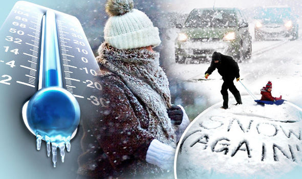
Temperatures are expected to plunge by more than 10C compared to last Sunday with lows sinking to minus figures overnight.
It is going to turn wet and windy with temperatures much colder than the beginning of the week.
Nicola Maxey
Bitter winds in the north will make it feel close to -10C (14F) by next week with the chance of snow over high ground.

The region will shiver in overnight lows of -2C (28F) this weekend while elsewhere will be lucky to see anything higher than 12C (54F).
Met Office forecaster Nicola Maxey said: “It is going to turn wet and windy with temperatures much colder than the beginning of the week.
“Polar maritime air will move in while colder air aloft will be brought down by rain making it feel much colder.
“There is a chance of wintry showers and hail in the north over high ground with even some to lower levels.
“It will stay fairly changeable and will remain fairly cold over into the weekend and over the next few days.”
Gardeners have been warned not to be lulled into a false sense of security with frosts threatening sensitive plants.
After spring kicked off with a burst of warm weather experts warn of a different story Saturday and Sunday.
Netweather forecaster Nick Finnis said chilly winds will make it feel close to -10C (14F) in exposed parts of the north.

He said: “It is not looking particularly warm over the weekend, temperatures perhaps staying in single figures in the north, into low double figures across the south.
“Low pressure over northwest Britain transfers south into the Bay of Biscay by Sunday, with an easterly or southeasterly wind developing.
“Sunday is looking mostly dry though perhaps cloudy for many and a risk of rain later across the far south.
“There is a risk of frost overnight where skies clear.”
The Met Office predicts a grim outlook for the rest of the month with gales, hill snow and below-average temperatures on the way.
A spokesman said: “Showers could be heavy at times with a risk of thunder, mixed with some drier interludes, but possibly with some hill snow in the north.
“The rather unsettled pattern will continue, but with the southeast increasingly seeing the better of any drier spells.
“[It will be] windy with a risk of gales, more especially in the southwest.
“Winds will generally be moderate throughout, but strong along exposed coasts with a risk of gales in the southwest.”

WeatherOnline forecaster Garry Nicholson said: “A slow moving weather pattern over the next few days brings low pressure close to the country, and unsettled, showery conditions are expected for several days ahead.
“There will be some heavy prolonged bursts of rain, hail and thunder at times.
“Temperatures will be rather cool, below average for early April.”


Политика конфиденциальности | Правила пользования сайтом